Get the Scoop on Where to Live in Abilene
Its small-town charm and quaint feel make Abilene, Texas, a great place to raise a family or settle into a quieter life. But that’s not all you’ll find here — this easy-to-navigate city is clean, overflowing with outdoor recreation options and home to a bustling downtown that’s full of standout restaurants and shops. But… the question remains, “Where should you live?”
The answer is slightly ambiguous — mainly because there isn’t much of a delineation of neighborhoods in Abilene, and even so, they tend to offer similar amenities. Explore the best option for you while learning from locals.
Super Neighborhoods of Abilene
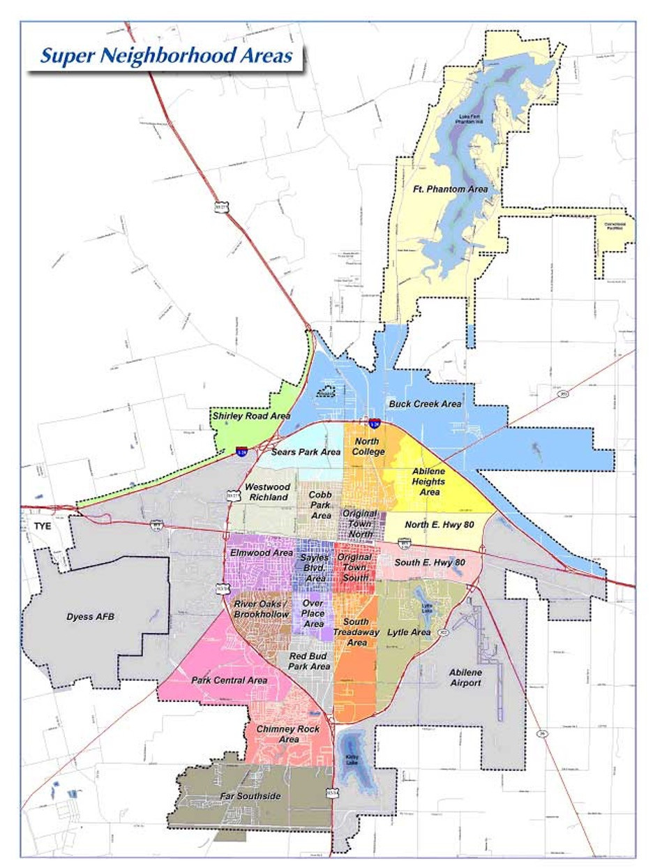
Trying to decide where to live in the Abilene area? Below is a look at Abilene’s Super Neighborhood Boundaries including a PDF profile of each neighborhood from the City of Abilene.
Super Neighborhoods
Download
Abilene Heights
Download
Abilene Airport
Download
Buck Creek
Download
Chimney Rock
Download
Cobb Park
Download
Dyess AFB
Download
Elmwood
Download
Far South
Download
Fort Phantom
Download
Lytle
Download
North College
Download
North E Hwy
Download
Original Town North
Download
Original Town South
Download
Over Place
Download
Park Central
Download
Redbud Park
Download
River Oaks Brookhollow
Download
Sayles Area
Download
Sears
Download
Shirley Road Area
Download
South E Hwy 80
Download
South Treadaway
Download
Westwood Richland
Disclaimer
These map products and all underlying data were developed for use by the City of Abilene for its internal purposes only, and were not designed or intended for general use by members of the public. The City makes no representation or warranty as to its accuracy, timeliness, or completeness, and in particular, its accuracy in labeling or displaying dimensions, contours, property boundaries, or placement or location of any map features thereon.
The City Of Abilene makes no warranty of merchantability or warranty for fitness of use for a particular purpose, expressed or implied, with respect to these map products or the underlying data.
Any users of these map products, map applications, or data, accepts same as is, with all faults, and assumes all responsibility for the use thereof, and further covenants and agrees to hold the City harmless from and against all damage, loss, or liability arising from any use of this map product, in consideration of the City's having made this information available.


